FACT-FINDING MISSION REPORT
2007
Objectives
Various progressive organizations hold a fact-finding mission on several coastal communities of Guihulngan City and Vallehermoso in Negros Oriental and San Carlos City and Calatrava in Negros Occidental.
The FFM was prompted by the start of the exploration drilling to an area in the waters off the western coast of Cebu on November 10, 2007.
The exploration drilling was granted by the Environmental Management Bureau of the DENR amid the oppositions of local fisherfolks organizations PAMANA-SUGBO and PAMALAKAYA-Negros and the questions raised by environmentalist groups.
The FFM aims to document the alleged fish kills, reduction of fish catches and destructions of the “payao” during the exploration since 2005.
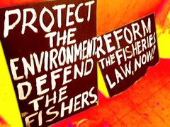
The FFM result will also be used in the current campaigns initiated by PAMALAKAYA and DEFEND PATRIMONY Negros to stop the oil and gas exploration in Tañon Strait.
Methodology
The team is composed of 12 members from different people’s organization. The team includes the PAMALAKAYA-Negros, PAMALAKAYA-North Negros District, PAMALAKAYA-Vallehermoso, BAYAN, GABRIELA, Aglipayan Forum, and Timbang Satellite Environmental Volunteers Organizations of Cadiz City.
The team visited 8 coastal communities from Guihulngan City, Negros Oriental northward to Calatrava, Negros Occidental. These are So. Cotcot of Barangay San Isidro, Calatrava; So. Sumulog and So. Lawis of Brgy. Buluangan, San Carlos City; So. Look Uno, Brgy. Poblacion and So. Baybay of Brgy. Pu-an, Vallerhermoso, Negros Oriental; So. Lamacan of Brgy. Malusay, So. Pier of Brgy. Bulado and So. Bocana, of Guihulngan City, Negros Oriental.
The team also visited local public officials for an interview. The team made courtesy visit to Mayor Perla Fernandez of Vallehermoso, Negros Oriental and Vice-Mayor Cesar Macaluja of Guihulngan, Negros Oriental.
Two methods were used by the Team, the Focus Group Discussions and Key Informant Interview. In FGD, A group of fisherfolks sat and shared with the FFM team to discuss the issue facilitated by the team leader. In Key Informant Interview, the team interviewed one person, who may have deeper knowledge of the issues.
The Team interviewed 15 key informants from the visited area, most of whom are municipal fisherfolks.
THE TAÑON STRAIT
The Tañon strait separates Cebu and Negros. Its peripheral provinces are Cebu, Negros Occidental and Negros Oriental. The Strait has a total coastline of 452.7 km. and a total area of 3,108.00 square kilometers. It is relatively deep with the deepest at 509 meters. Its coast is sharply sloping and fringe with reefs.
Tañon Strait is bounded with 36 coastal municipalities and cities of Cebu, Negros Occidental and Negros Oriental. Small islands and islets can be found at the central part and northern boundary of the Strait.
Patches of mangroves aggregates are found in the southern coast at both sides of Negros Oriental and Cebu. There are 188.3 sq. km. of coral reef within the strait, composed mostly fringing reef along the Negros and Cebu coastlines.
The Strait is a distinct habitat of the chambered nautilus (Nautilus pompilius, local name taklong) and a migration route of Whale sharks (Rhincodon typus). It is home to at least nine species of cetaceans, the most interesting of which are the Dwarf sperm whales (Kogia simus) and Melonheaded whale (Peponocepala electra). Thus, the strait is one of the priority areas for conservation of cetaceans and reef fishes.
The rich marine resource of Tañon Strait is the basis for the Presidential Proclamation 1234 by President Ramos on May 1998.
Tañon Strait is one of the major fishing grounds of Central Visayas and is identified as major source of squids. Based on the survey of the BFAR and the Coastal Resource Management Project (CRMP), there are about 26,850 fishers operating in the area and more than 12,000 motorized and non-motorized boats.
Tañon Strait is particularly the fishing grounds of Eastern Negros Occidental and Negros Oriental and Western Cebu. Study shows that Tañon Strait have the highest number of gillnets (kurantay (drift gillnets) Palabay (bottom gillnets), patuloy (surface-set gillnets), hooks and lines (pamasol) and squid jigs among the major fishing grounds of Central Visayas. Beach seine (sahid / baling) is also concentrated in Tañon Strait, although declared illegal is tolerated.
THE OIL EXPLORATION IN TAÑON STRAIT
In a desperate effort to achieve energy independence within 6 years under the Medium-Term Philippine Development Plan (2004-2010), the government has been awarding service contracts to various foreign oil and gas exploration company around the country. To date, there are 28 Service Contract, 1 GSEC and 9 Petroleum Energy Contracting Rounds (PERC).
In December 21, 2004 the Philippine Government awarded to JAPEX-Philippines, Inc. the Service Contract 46. The Service Contract 46 covers 2,850 square kilometers offshore of Tañon Strait covering 13 barangays in Pinamunghan and Aloguinsan towns in Cebu; 14 towns and cities in Negros Oriental and 4 towns in Negros Occidental.
JAPEX-Philippines is a 100-percent subsidiary of Japan Petroleum Exploration Co. Ltd., a leading Japanese upstream company engage in oil and natural gas exploration and production (E & P) activities both in Japan and overseas. JAPEX employs some 1,470 employees worldwide.
In May 2005, JAPEX holds a 751-kilometer multi-channel sub-bottom profiling survey using the M/S Veritas Searcher and two chase boats. It carries a 3.5 kilometer cable
Seismic surveys are used to determine the structure of underground rock formations by firing explosive charges in the ground. The intense sounds produced reflect back to a receiver to provide information about oil and gas deposits that may lie beneath the seabed.
According to local fisherfolks, the survey operates on a 24-hour basis. They could hear sounds of blasting at an interval of 5-20 seconds much like that of a thunder and as if the ship furrowing the undersea.
According to Energy Undersecretary Guillermo Balce, Tañon Strait is expected to produce 1 Billion barrels of oil. Out of this potential reserve, about 100 million barrels of oil can be recovered.
Starting November 10 this year, Japex plans to drill a hole 3,150 meters-deep in an area some 3 km west of Pinamungajan town in western Cebu. JAPEX will use the Mobile Offshore Drilling Unit (MODU), known as Hakoryu V.
If they believe that there is gas, they will set a 7" liner (steel pipe) to test the well but if gas and oil is negative, they plug the well with cement and abandon it. Another well within the contracted area will be drilled until they are certain of their data and information.
MAJOR FINDINGS
FISH CATCH REDUCTION
The team confirmed the fish catch reduction after the Seismic Survey of the R/V Veritas Searcher in May 2005. The fish catch reductions continue up to this day in all areas visited by the team. The average fish catch were drastically reduced by 50-70 percent from pre-oil exploration catch of 10-15 kilos average catch per day to 2-3 kilos of fish per day.
A local fish called “baga” (bucaobucao) almost vanished in the fishing grounds off the waters of Guihulngan City after the seismic survey. Before the seismic survey, fisherfolks could produce 15-20 kilos but thereafter, they could only catch an average of 1-2 kilos.
Fisherfolks attributed the drastic reduction of the fish catch to the destruction of the “payao” or the fish aggregating device” (also called as artificial reef). The team recorded a total of 136 payao destroyed during the 2-weeks seismic survey.
According to Rene Bulado, the chairperson of the Malusay Fish Loving People, a local fisherfolks associations and serving as a leader of the Guihulngan’s City Fisherfolks Associations Management Council (C-FARMC) said that one of the three boats of the JAPEX is the one destroying the “payao” of the fisherfolks. The bewildered fisherfolks were only handed with a one-page notice right in the middle of the sea.
A payao is an artificial reef made of Styrofoam materials deployed in strategic areas. The use of payao by the local fisherfolks contributes to high fish catch. Gango o Payao is the local name for artificial corral reef and indigenuous fishing technology defined as “man-made” structures set up in marine environment to serve as shelter, source of food, and breeding ground for different fish and other organisms in the absence of the natural habitat.
Its destruction therefore has affected the fish catch of the community. Some of the payao owners were paid but some were not. In Guihulngan and in Calatrava, JAPEX paid the fisherfolks P5, 000 per payao through the intercession of the Department of Agriculture. In some areas, payao owners were paid P 4,000.00. With the exception of Calatrava, most of the areas visited by the team have not replaced the payao.
It must be pointed out that while the project proponent paid the payao owners, the most numerous yet the most affected by the seismic survey have not received compensation for almost a week of being prohibited from fishing, the marginal fisherfolks. Most fisherfolks did not dare to fish near the survey vessel for fear of being rammed or hit.
FISH KILLS
Two local fisherman interviewed by the team confirmed the fish kills during the seismic survey. Of the 15 informants, three have confirmed the fish kills in their respective fishing grounds.
Marcelo Descaliar, a fisherman of Sitio Sumulog, Brgy. Buluangan, San Carlos City says that a day after the M/S Veritas Searcher zigzag the waters off their communities, at about 1 kilometer from the shoreline, the beach seine catches dead coral fishes. Fisherfolks from Guihulngan also told the team that marginal fishers have seen dead tuna on the waters.
Scientific studies have shown that “seismic blasting damages planktonic eggs and larvae found in the immediate vicinity of airguns and can reduces catches in commercial fisheries” (Dalen and Knutsen, 1985). Seismic blasting can cause behavioral modifications and reduce or eliminate available habitat for breeding / spawning, foraging and migration.
In Guihulngan, fisherfolks says that “baga” (bucaobucao in Ilonggo) almost vanished. Before the survey, Guihulngan is known as the sources of the “baga” in the province but now its almost gone.
NO CONSULTATIONS WITH THE FISHING COMMUNITIES
All respondents interviewed by the team express that they have no knowledge or information of the seismic survey and the exploration drilling at Tañon Strait.
One of the fishers even though that it is an illegal fishing vessels and even call for police to apprehend but bewildered to see the escort Coast Guard. Others though that the vessel is cleaning the seabed. Only a few knows that it is a seismic survey.
All of the local public officials interviewed by the team express disappointment on the apparent lack of information drive and subsequently of the exploration drilling. They said that the national government and national government agencies should have informed and consulted them.
Since the awarding of the Service Contract in 2004, the Department of Energy and the JAPEX visits the local government only this July till October 2007. Their so-called “information drives” were attended by a few people.
Amid the dangers that the seismic survey poised to the marine environment, JAPEX never informed the concern stakeholders in the Tañon Strait, there were no consultations or even information drives before the survey were conducted.
During Seismic survey, one of the chase boats handed down one-page flyers to fishers at the sea. The said flyers are informing the fishers to stay away from the survey vessel. There are coastal communities that were never informed of the seismic survey.
The lack of consultations with all stakeholders is apparent in the absence of participations of the fisherfolks and other concerned organizations in the process to secure the Environmental Compliance Certificate (ECC). It is not simply a matter of haste in approval of the ECC but the substance of the process itself.
While the projects involved cities / municipalities of three (3) provinces, there was no public hearing or consultations conducted in Negros Occidental and Negros Oriental but in their own words “visits”.
It is worth reiterating that when we mean “environmental impacts’ it is “probable effects or consequence of proposed projects or undertakings on the physical, biological and socio-economic environment that can be direct or indirect, cumulative positive or negative”.
This might have prompted Dr. Angel Alcala of the Silliman University and a noted marine biologist to say, “IEE document wanting in the critical survey data and information needed for determining the environmental and socio-economic impacts of the proposed operation of JAPEX”.
It is only recently that the JAPEX and the Department of Energy conducts “information drives” on each of the cities and municipalities within the coverage area of their Service Contract 46. Yet, these so-called “information drives” were miserably attended by a few people, mostly local government and national line agencies employees or selected fisherfolks leaders.
Yet, the process in acquiring the ECC were called as a sham, not only because they were lacking in consultations but also with the apparent denials by government agencies of all grounds posed by fisherfolks and environmental groups against the project.
WHAT SHOULD BE DONE?


1 comment:
Good words.
Post a Comment